Monday, December 26, 2011

Louis Tells a Story -Swift Excerpt

This excerpt from my novel "Swift" is the exchange between the three main characters and a fellow that has searched many years for the lost treasure. Louis is, of course fictitious, but is based on some very likable and dedicated treasure hunters of the the past few decades. -Ed


Louis Tells A Story


      Louis Eversole lived up a hollow in the mountains along a small clear stream. Louis and his wife, Sarah, lived with at least six dogs and therefore always aware of visitors a good two minutes before they got to the front porch. They had lived on this small mountain creek for 40 years. Louis and Sarah grubbed out a small garden beside the clear mountain creek running down past their house. The house and various out buildings rested comfortably between the rocky, hemlock covered hillsides typical of a mountain 
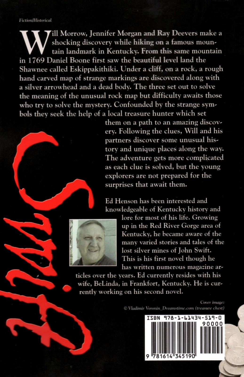
homestead. Louis Wayne Eversole was considered an expert on the legend of the John Swift Silver Mine and had spent twenty years or more chasing after the dream tale. Years ago, he had found the turkey tracks, haystack rocks and three creeks but he never claimed he had found a mine or any silver. In fact, Will Morrow had with him in his pocket more silver found in this country than Louis had ever seen. Ray had convinced Will he should meet Louis and discuss the tales with him. Of course, they were not going to say anything about the map.
      Louis was sitting on his front porch with Sarah enjoying the cool breeze coming down the hollow over the rippling creek. Will pulled his truck up in front of the house. Louis, although not fearful, was curious and tried to recall anyone he knew who would be driving a fine new pickup truck. With dogs and his handy rifle by the front door, Louis knew he could determine the danger level once someone showed themselves from the truck. Ray jumped out first so that Louis would know who it was.
      “Howdy Louis!” Ray yelled out.
      “Ray? Ray Deevers! Well, what in the world are you doing up here in God’s country?” Louis questioned as he got up from the porch swing and moved toward the steps leading up to the porch. “Hush dogs!” Louis yelled. The dogs immediately quieted down but milled around sniffing the guests as each got out of the truck. The boss dog marked the truck tire, indicating the truck and visitors were now in his territory.
      “Louis, this here is Will Morrow and Jennifer Morgan. And I apologize for just dropping in on you all without calling ahead,” Ray introduced them.
      “Nah. Ain't no problem Ray. Glad to meet you folks, come on up on the porch and sit and a spell. We don’t get much company up here,” Louis politely invited.
      “Thanks Louis. This sure is a pretty place you have here,” Ray commented.
      “We like it. It’s quiet anyway. Say, are you folks thirsty? Honey, why don’t you bring these folks something cold to drink, maybe some of that good sweet tea you make, if you don’t mind,” Louis turned and glanced at Sarah.
      “No, thanks Mrs. Eversole. We’ve had cold drinks on the way up here. We appreciate the offer though,” Will answered for all three.
      “Are you sure, it ain’t no trouble at all,” Sarah quickly followed.
      “Oh, yes, Mrs. Eversole. Will is right. But we appreciate your kind offer,” Jennifer quickly and politely responded.
      “Well, Ray what’s on your mind?” Louis point blank asked Ray while studying all three people one at a time.
      "Louis, we get out, uh, the three of us get out ever now and again to rock hunt and general exploring cliffs and caves. The other day we ran upon a turkey track and some other markings. Well, here, Will you explain it to him,” Ray said pointing to others.       
      “Got the silver mine fever, do we?” Louis jokingly remarked, eliciting a modest chuckle from everyone.
      “Mr. Eversole,” Will began.
      “Call me Louis. There ain’t no big ‘I’s and little ‘u’s around here. Louis’ll be fine,” Louis interrupted.
      “Okay, Louis. We are interested in the John Swift Silver Mine. Ray here says you’re the man, the one that knows all there is to know about the Swift Lost Silver Mine. We’ve been interested in the legend and all, well, we just have come up with a few questions,” Will fumbled for the words.
      “What do you want to know?” Louis questioned.
      “Anything you might want to share about your experiences and knowledge of the legend.”
      “Heck, you can check on them computers Internet or something and find all about John Swift,” Louis responded.
      “We can’t find out what Louis Eversole knows on the Internet; I’ll guarantee that,” Ray boasted. With that statement Louis was encouraged and primed to tell all. Louis had spent years following leads, tales and not many folks asked him about the story much anymore. In fact, not many people knew about the tale of the lost silver mine.
      “So you think the turkey track carvings you found might have something to do with the silver mine?” Louis questioned.
      “We don’t know. I’ll tell you one thing though, I never saw carvings like this before,” Ray answered. Both Jennifer and Will gave Ray a casual, quick glance just to let him know not to talk too much. Ray got the message and became quiet. Louis paused for an uncomfortable amount of time.
      “Well, let me see. I started, well, got interested you might say, in the sixties. There were some fellers from Virginia that came into this country and spent a small fortune lookin’ for that silver mine. I eventually hooked up with them, as a kind of a guide you might say, to these hills. I had heard of the story all my life, mostly from my daddy, but I never was much interested until the Virginia boys came along. After taking them to various places each year (they would come every year in the fall) I learned a lot about the silver mine. They were convinced that the silver mine was somewhere down around the cliffs of Chimney Top Creek,” Louis began.
       “They had maps, testing equipment, and most important to me a copy of what they claimed to be the authentic journal left by John Swift himself,” Louis added.
      “Did the journal give exact directions to the mine?” Will asked.
      “No, not directly. It was more like clues. It described rocks and creeks. The journal, I have a copy around here somewhere, Swift claimed to have written himself so that he could find the mine again. He said that he mined silver, smelted silver and made counterfeit English crowns in the wilderness south of the Ohio River and west of the big mountains from 1760 until 1769. Swift claimed he was captured by the British and put into prison for siding with the colonists on one of his trips to England,” Louis continued.
      “Why did he go to England?” Ray asked.
      “Oh, well, John Swift said he had a very successful shipping business prior to the revolutionary war and actually owned a fleet of sailing ships, according to his journal,” replied Louis. “Anyway, while in England he was thrown into prison for many years. By the time he got out, Swift was blind and couldn’t find the mine. So he wrote down everything he could remember, descriptions of rocks, rock houses etc., and with others acting as his eyes tried to return to his precious mine,” Louis concluded.
      “Let me ask you, how did he find the mine in the first place?” Will asked the all important question.
      “George Mundy. He met George Mundy when Mundy was a war prisoner in General Braddock’s army. Mundy was a Frenchman that had been captured by the British and colonists. Swift says that he befriended a man by the name of George Mundy who told him he had been mining silver south of the Ohio River. Apparently, after that, Mundy took Swift to the mine along with a company of men to work in the mine. That’s the way I understand how it went anyhow,” Louis said.
      “Braddock’s army? George Mundy?” Will was getting confused.
      “Well, you see, Mundy had found the mine from the Indians and had been working the silver out himself. It always seemed to me old Mundy might have bought his freedom by telling Swift of the silver mine. Anyway, Mundy led Swift and some of his associates to the mine around 1760, according to Swift’s journal.”
      “Do you still believe the mine exists?” Jennifer interjected wanting to get to the bottom of the line of questioning.
      “Yes I do,” Louis said wholeheartedly. “Just because I ain’t found it after searching so long, doesn’t mean squat. I’ve not been in all the right places. Ray, do you remember going to Jellico?” Louis turned to Ray.
      “Sure do, we had us a heck of time that weekend. Met some strange people though.”
      “Well, each of us were bitten by the Silver legend and it may seem a little strange, but I got to say I have had some good times and thought I was close once or twice,” Louis said.
      “Seems like if Swift sailed ships he would know how to clearly mark his trail to the mine,” Will pondered.
      “Well, he was a captain of his own ship and claimed to own more ships. He did write down the latitude of 38 degrees and 11 minutes in his journal. So we can only conclude Swift had the proper instrument to plot coordinates,” Louis added.
      “What about the longitude?” Will asked.
      “Unfortunately, all the journal says is that it was near 83° longitude. I always thought Swift left it that way since all he really needed to do was get into the general area and he could find the mines,” Louis responded.
      “That opens up quite a big area, I guess, if the journal information is correct,” Ray added.
      “Where do you think the mine is located? Uh, assuming it really exists, of course,” Will laid it out point blank.
      “Son, if I knew, we sure as hell wouldn’t be havin’ this conversation, would we? Oh, I guess I’ve always felt it was somewhere in these cliffs around here. All the landmarks Swift mentions in his journal are here, and we are pretty close to the 38 degree latitude and there sure are plenty of places it could be buried on these mountains. I just have not been able to put it all together,” Louis concluded.
      “We think the carvings we found are some kind of a crude map,” Will remarked.
      “What kind of a map?”
      “Well, in fact this map and the carvings, are on the back wall of a big sandstone rock shelter.”
      “How do you know it’s a map?”
      “Well, there’s more,” Ray interjected.
      “Do you have a picture of it?”
      “We have a drawing of it,” Jennifer said as she pulled out the map.
      “Let me see here, I’ve seen a lot of carvings and markings the past forty years,” Louis responded. Louis carefully studied the hastily drawn map. He couldn't immediately tell anything from it right away, other than easily recognizing the large and small turkey track markings. The map only contained the turkey tracks and the lines. The other symbols, the eye, the x’s, and the half moon with lines on it were purposefully omitted.
      “How big is this thing, the carving I mean?”
      “I’d say it is five feet high and probably six or eight feet across,” Ray explained.
      “That big, huh? And you say these markings are carved on the wall of a rock shelter?”
      “Yeah, although they're covered with moss and other stuff growing on the rock. We would not have seen the thing except for the way the light happened to hit it on the day we were there.”
      “And these lines, Louis pointed, are carved all the way across the map?”
      “They are.”
       “We think the map is in Kentucky somewhere but can’t figure out where.”
      “Ray thinks this is either the Licking or Big Sandy River cause he thinks the lines at the top are the Ohio River. What do you think?” Will asked.
      “Are the carvings deep?” Louis asked.
      “Pretty deep. Someone spent some time carving these symbols into the rock for sure. They wanted the carvings to be there for a long time. There were no names or initials carved, either.”
      Louis became more interested now. Although he had seen about every kind of carved turkey track in the country he was quite certain he had never encountered anything like this. He would love to see the rock carving for himself. Perhaps it was a piece of the puzzle he had been trying to solve for the last twenty years. Louis knew equally as well that he would not get all the information and likely would not be invited to see the rock carving during this visit; it was just the way treasure hunters behaved.
      “So what do you think Louis? The Licking or the Big Sandy?” Ray asked.
      “If I had to guess right now I’d say neither,” Louis finally announced.
      “Neither?” Ray exclaimed in disbelief that Louis had just shot down his theory.
      “My opinion is it’s the Warriors Path,” Louis added.
      “Warriors Path?” Will questioned.
      “Yes, the Warriors Path. You see, if these lines represents the Ohio River, and I think they do, then why wouldn’t you put all the rivers in the map? Just putting one river in would virtually make the map impossible to use. Heck, a person wouldn’t know if they were on the Big Sandy or the Kentucky River, or one of the other rivers, or even a big creek. Nah, I’d say it was the Warriors Path,” Louis concluded.
      “Where is the Warriors Path?” Jennifer excitedly asked.
      “Runs along the edge of the mountains before you get to Winchester. Runs all the way from up north down through Cumberland Gap into Tennessee. It’s on the early maps of Kentucky, the one John Filson made, I believe,” Louis answered.
      “Well, I’ll be,” said Ray, astonished by this new information. Ray knew about where the Warriors Path was located based on this description.
      “Do turkey tracks point to something, generally? I mean do they point in a direction?” Will asked Louis for confirmation to his previous claims.
      “I always heard and believe they do. A simple way to show a direction to go. The turkey foot would be pointing in the direction the ‘turkey’ is walking,” Louis offered.
      “Well, this certainly has been interesting and we very much appreciate your time and help,” Will said.
      “So, you folks think you are on to something?” Louis asked.
      “Something, but who knows what. It’s fun to chase after it, though. Good exercise and heck, we meet some interesting folks like you and learn a little history too,” Will commented.
      “I guess it wouldn’t do any good to ask where this rock carving is located,” Louis remarked.
      “Let’s put it this way, it’s on the western edge of the mountains,” Ray answered.
      “Then I’m pretty sure the line on the carving is the Warriors Path. Look around the rocks, there might be more turkey tracks and other carvings. Check it out good,” Louis advised.
      “Mr. Eversole, may I take you and your wife's picture?” Jennifer politely requested.
      “Why, I don’t see why not.”
      After the photographs were completed and the group loaded up, they headed back home to Frankfort. Now they had all new information and an appreciation for both the famous legend and at least one searcher of the treasure.
      “I noticed you never showed him the silver arrowhead,” Jennifer said as they drove west on the interstate.
      “No, I was afraid it would have been a bit too much,” Will said.
      Ray agreed. What they did know was that they needed to regroup and re figure the meaning of the map. They also knew they had found not one, but two, turkey track carvings much closer to the Warriors Path than the one they had seen on the rock bridge.
                                                                   
Want to read the rest of the book? "Swift" is available at Amazon.com, Barnes and Noble and all the usual places. If it is not at your favorite bookstore just ask them and they will order it for you. But an easier and secure way to purchase your hard copy or eBook is by simply clicking right here at edhensonbooks.com. You can place your order and if you download your eBook you can be reading it in just a few minutes!  Also there a couple more chapters there to help you decide!

Monday, December 19, 2011

Landmarks

    In nearly every version known of the Swift journal there are a lot of landmarks. Swift describes a rugged, rocky dense forested area where his treasures are hidden. As the journal was copied over and over down through the years no doubt mistakes were made. Likely some landmarks were omitted while others gradually were added.
Gray's Arch with part of large Rock Shelter
    "You can stand on top of the hill above Buffalo Rock and look towards the west and see a hole through the cliff and the sky beyond. We call it Sky Rock or the Light House. Not far west of the mine is a small creek that sinks underground, and we called it the Drying Ground or Sinkon Creek.  About a mile west of the mine we cut turkey tracks under a cliff pointing backwards to the mine..."
Indian Stairway
    "He (Munday) led us to the Indian Stair Steps. You can stand on the top of the stair steps and look across the creek at the mine and the cliffs are in the shape of a half-moon...near the mine is a large drain at the head of which is a rock that resembles a haystack. We called it the Haystack Rock.  Where the ore is, the cliff is in the shape of a half-moon..."*
Half Moon Cliff 
   These descriptions are taken from a version of the journal believed to date before 1859. There are many variations and even a lot more descriptive terms in this journal. It is interesting that a rock called Half-Moon was mentioned twice in the journal. Rocks and landmarks resembling these clues can be found in a few places in the regions of Kentucky, Virginia  and Tennessee. These indicators are to the mines and Swift claims to have had mines working two veins of silver ore. He referred to them as the upper and lower mines.
Haystack Rock
    Other descriptions were provided to hidden or buried caches of silver coins and ingots that Swift and company smelted and minted from the silver ore supposedly.
    These are just a few of the many clues that are included in various journals and they can be found in more than one area and even in other states. Last update Kiowa Muncie took us to a really unique site that he has discovered many of the markings and features. He also found some fascinating formations and natural features. We will continue to watch his progress on his search efforts.
Rock Bridge spans Swift Creek
    Now landmarks associated with the Swift journal vary as well. While the condensed version of one of the journal variations list the places shown above other versions speak of different clues. In one version Swift speaks of a bridge crossing a stream. Could this be the Rock Bridge of Swift Creek? On top about midway across the natural stone arch is a carved turkey track. Though very faint now it has been there for many years. Of course Swift mentions carving turkey tracks in the rock pointing the direction of the mines. Swift speaks of a place where three streams come together and said " don't ever stop looking for the mine there."


 In this early map done by John Filson the three forks of the Kentucky River clearly are shown coming together. Interestingly enough James Harrod, founder of the first fort and settlement in Kentucky actually disappeared while searching for the Swift Mines at the three forks of the Kentucky River! You can read more about James Harrod's connection to the Swift legend here.


*Lost Silver Mines and Buried Treasures of Kentucky, Paul Henson, 1972 pp 9-14


Sunday, December 4, 2011

All Clues Lead To Swift

Note: This issue of the Swift blog features Kiowa Scott Muncie, a modern day Swift researcher. Kiowa has long been interested in the Swift Legend and has amassed an extensive knowledge of the legend and Kentucky history.


    My name is Kiowa Muncie, better known as "Ki" to some. I like to think of myself as a treasure hunter of the Red River region in Eastern Kentucky. I was born and raised here exploring and hiking the Gorge for the past twenty years. Ten of those I've spent learning and searching for Swift's lost mines. During that time I've come across some amazing things. Perhaps the most amazing thing I found merely by accident will have a profound effect on the rest of my life.
    I'll start with what I've come to call Swift's West Mine. I was out on a mushroom hunt one spring walking cliff lines, new country to me at that time, a very remote wilderness with no road or trail for miles. I found myself turned around with the feeling of being lost. I did not panic and eventually I began to find my way back. From out of nowhere I come upon a place in the cliff with a small route up to the second ledge, so I climbed up and continued searching the cliff line crossing over to the other side of the ridge. From there I noticed what appeared to be a old worn trail that went along the second ledge. So, out of curiosity I followed the trail to the end only to find a hole that went strait back through the cliff. I made a mental note, snapped a few pictures and pushed on to find my way back home.
    It wasn't until a few years later that I made the connection of the place being a possible Swift site. My curiosity took me back to the site where my exploration began. In searching other possibilities of what this place could be I was left with this conclusion. The place was an actual man made hand cut shaft. I could now consider it a mine and through exploration of the mine there appears to be areas of suet. Experts have informed me this could be from the early use of cane torches as a light source. There are noticeable chisel marks along the walls leading back to an area that widens. At this point a sizable dirt pile blocks the rest of the passage. A carving of a bell can be found at this location. Outside the shaft is a rock of the same type possibly used to seal the entrance. Here there is a carving of an anchor, the initials "JO.S" and other curious markings can just within yards of the mine as well.  Swift mentions in his journal that he "concealed all traces of his workings by filling them in with dirt, and placing a rock in the entrance." 
    My curiosity still wasn't satisfied; I needed to know more, To find my answers I explored the surrounding area. To my amazement I discovered an area where you can actually stand and look across over to the mine. Swift also tells of a place where he stood and looked across over to his mine. I believe this could be the Lookout Rock he spoke of. My reason for believing this is a set of carvings I found next.
    On a rock very near the lookout rock are a set of very interesting carvings. They are a "JS," a pair of turkey tracks, some other curious marks and a date that appears to be 1761. Now this really got me excited since the carvings appear to be very old and cut deep in the rock. After study of the carvings the turkey tracks do appear to point back to the mine but they also point back to another place I found on the way into the area of the mine. Could the carvings on the "JS" rock be pointing out key places? 
    Located near a big saddle gap on an adjoining ridge is a peculiar rock with a small natural arch or window, the only one of its kind in this immediate area. On this rock is the large carving of a triangle cut deep in the sandstone. This is a carving that really catches your eye when you walk up on it. The place is also easy to find. Most Swift legend researchers know that Swift told of being attacked and having to bury some of his silver. I was in awe to be asking myself this question, could this actually be a Swift cache site?
     Swift does tell us that in 1761 he was attacked by Indians as he started for home. The Indians shot a hole in his pack causing him to lose part of the silver. He tells of concealing part of the years work near a symbol of a triangle cut on a large slanted rock.
    Swift also mentions in 1762 after a summer of mining he'd set out for home only to be attacked by Indians near the mine. Here he again tells of leaving a valuable prize and two horse loads of silver near a large gap marked with curious signs and symbols. In 1769 Swift tells of traveling back through the area going by the place and seeing all things as he had left them. This was his last time in the area. So now we are left with this question. Is Swift's silver still hidden somewhere here? To answer that question will take recovering some of Swift's silver to ever really be sure. In my quest for the truth while seeking new clues Swift left behind has only ended one chapter in my search and begins a new one. Now it's finding the truth of the clues, the clues I feel that have led me to Swift's West Mine.


Kiowa has promised to submit at least another article in the months ahead. One will have to admit that he has identified some pretty interesting markers and places. If you have comments for Kiowa or any blog post please leave them in the space provided at the end of the post. We welcome any discussion and ideas you may have. Also, visit edhensonbooks.com and check out my new book "Swift."

Monday, November 21, 2011

Some Interesting Things Along The Way

Lot's of very interesting carvings are found in some very unusual places. 

   I noted before one of the greatest pleasures of researching and writing about the John Swift legend was the opportunity and need to travel around the state to gather up information. I always keep my camera handy and usually snap a few shots to jog my memory later. Indeed some of the previous blog posts resulted in being in a place that seemed, at least to me, interesting at the time. We have such a beautiful and diverse state with equally beautiful and diverse people. So, if you are interested here are some more things I ran across that struck my fancy as I explored for the book Swift..
    Presently, believe it or not I have started on my second book. I can't tell you about it yet but just like the first it requires me visiting some pretty neat places and meeting some interesting folks to put the project together. Now I confess I never intended nor do I have the ability to be a great author. I wrote Swift, because, well, it needed to be written. The story needs to be told again and again. Just think, this legend is OLDER than our state. It has been passed along from one generation to the next. It is our turn to pass it along to the next and my aim was to do that with this novel. Now while my book is just a yarn the legend and some pretty important episodes in Kentucky's history are included. Anyway here are some  neat things around the state that caught my attention.
A picture is worth a thousand words, they say


On the seventh day of June, 1769  "I saw with pleasure the levels of Kentucke"- Daniel Boone
This photo from Pilot Knob provides the wonderful view of the Bluegrass Region


I like to eat and any restaurant named the Cornbread Cafe will get me every time! 
Worth the stop too!


Overlooking the city of Pineville, Ky is the magnificent Chained Rock overseeing the narrow passageway that the famous Wilderness Road negotiated the rugged mountain

The Cumberland Gap provided one of the few passageways for Boone and the rest of the pioneers to access the lands they called Kentuke

The old swimming hole on Indian creek in the middle of Swift country

The Salt Festival at Big Bone Lick State Park provides the opportunity to see many pioneer crafts and skills

They still boil the brine water at Big Bone Salt Festival producing salt in the same manner as pioneers  

At the Archaeology Weekend at Gladie in the Red River Gorge native American and pioneer skills are demonstrated ranging from pottery to cattail houses 

Cattail house
     If you arrived at this blog site looking for more information about the Swift legend and things associated with the famous lost mines, just check out the archive over in the right column. I have planned to introduce you to some real modern day Swift treasure hunters in future blogs including a guest blogger in the near future with some amazing stories. Also coming will be an excerpt entitled Louis tells a story from my book Swift .Be sure to sign up for a reminder so that you will not miss these exciting posts. Thanks for dropping buy. 


    Click here to return to web page.


Wednesday, November 16, 2011

Some Updates

    Hello everyone. Thank all of you that regularly follow my blog site. You that have been with me from the beginning are aware that my subject materials are mostly about the legend of John Swift's lost silver mines, my book and descriptions of the places that are the basis of the stories. From time to time an odd piece shows up simply because it is something I encountered and found interesting. In the past year I've usually posted something about every week. Now that my book is out and requires more promotion time I need to make a schedule change in my blog.

    Starting November 21st I will be posting every two weeks or twice a month.

    I will also begin to expand into other areas of interest, especially unique places and people. 

    The next post is scheduled for November 21st  and is entitled Some Interesting Things Along the Way.

     Please don't forget to join my blog so that your email will get a notification when the posts come out. It is easy to sign up on the "follow" link in the right column. And tell others about the site as well.

     Finally, if anyone has any ideas, suggestions for improvement or would like to post something on this blog, send it along and I will be glad to share it with everyone. I know everyone has places they just find special and would like to share with others. This is the place to get that message out. Of course, I don't mind selling a few books along the way if any new followers are interested. The book, both hard copy and eBook versions, can be purchased right through my own secure website: http://edhensonbooks.com/.

    Thanks everyone for following!


Monday, November 14, 2011

Indian Stairway Video

    I've already posted about the Indian Stairway but I thought you might enjoy this video (less than a minute) made this year on the stairway in case you missed it on a previous post.
 Indian Stairway

Monday, November 7, 2011

Daniel Boone Through Cumberland Gap

Cumberland Gap provided the easy route through the Cumberland Mountain
    One important element of the story "Swift" includes the history surrounding Daniel Boone's successful effort to reach the Kentakee land west of the rough Allegheny mountains. History records Boone made his first unsuccessful attempt to reach the wonderful and bountiful lands in 1767.  Captain John Swift claimed in his journal that he and a company of men mined ore and smelted silver in the same wilderness during the years of 1760 through 1769.
The "Narrows" through the Pine Mountain at Pineville, Ky. 
    Boone negotiated the passes of the Cumberland Gap, named for the mountain through which the eroded valley allowed a horse trail and the narrows of the Pine Mountain following the Cumberland River. He and his party became disoriented and failed in their first attempt. On his second attempt in 1769, with John Finley as his guide, Boone reached the great hunting land and beautiful level savannas that he had heard about and his old friend John Finley already knew about. On June 7, 1769 Boone climbed the mountain today known as Pilot Knob and viewed "with pleasure the beautiful levels of Kentakee."
Pilot Knob as seen from the Parkway crossing Eskippathikiki
 So as it turns out both characters supposedly were in the Kentucky during the same time yet neither mentions the other. Daniel Boone's exploits soon became famous and by the end of the decade he was about the business of bringing new families to settle the frontier.
    Swift, on the other hand, claims through his journal, to have ceased his mining and counterfeiting operations in 1769 and departed the wilderness. He did attempt to find the mines in later years but he was old and blind for his time in prison. Swift died it is believed in 1800.
    In my book Swift, Boone and Swift do encounter each other and the results are quite different than the historical records reveal.

Monday, October 31, 2011

The Cloud Splitter

The Cloud Splitter in the distance as seen from Chimney Rock
     Sometimes I get asked if the Indian Stairway and the Cloud splitter are the same cliff. They are not but they are located in the same general area of the gorge. Here is a link to a map which gives a good indication of the proximity of the two landmarks.
Chimney Rock in RR Gorge
     The two rocks do have a similar appearance but only the stairway has ancient carved steps. The cloud splitter, on the other hand, is a neat climb and offers grand views of the Red River country.The shot here was made from the lookout on top of the Chimney rock, perhaps next to Sky bridge, the most famous landmark in the Red River Gorge. The Indian stairway, shown below, is sloped enough to provide access from the ridge top and the valley below. To see a short (less than a minute) video clip of actually climbing down the stairway go here.
View of Indian Stairway
    

    These landmarks are located in the one of the most famous of the Swift legend areas. All types of clues from different variations of the Swift journal refer to various rock formations and landmarks. 
    Some archaeologist now speculate that the Indian steps were not made by prehistoric peoples at all but rather from historic nitre   mining operations. Nitre,once was mined from the rock houses that are located in abundance throughout the Gorge. The substance was an essential ingredient in making gun powder. The theory offered up by modern archaeologists proposes that the steps were carved for the the miners to carry off the loads of the precious material. The idea revolves around the relative rapid rate of weathering and erosion of the sandstone. That may well be the case but personally with the identified Adena shelter located just above the stairway, I cling to the prehistoric theory.
    

Sunday, October 30, 2011

Press Release

    A press release is out to several weekly newspapers as well as a web press release through PRLog. Check it out here.


    If you like this blog be sure to tell others, share on Facebook and Twitter and above all follow. That is easy, just click the follow button and you'll be notified of each new posting.  Watch for tomorrows posting about "The Cloud Splitter!"

Monday, October 24, 2011

Facebook Swift Pages

     For those of your that arrive at this blog from my web site http://edhensonbooks.com/ and have a keen interest in more detailed information about the Legend of John Swift's lost silver mines there is a Facebook group page. Check out Swift Silver Mines for some fantastic information and discussion by some modern day treasure hunters and experts. While you're at it check out my Swift page. I just started when the book came out  but I would appreciate stopping by and liking my page and leaving your comments if you like.

Friday, October 21, 2011

Goddard Covered Bridge

    At the last count Kentucky has only thirteen covered bridges left. At one time there were as many as 400 covered bridges located around the state. Many were destroyed during the civil war. With new roads for motor vehicles new bridges were required and the old wooden, truss covered bridges have quietly faded from memory.


    The few remaining covered bridges are now are preserved and maintained as important historic landmarks. Only a couple are still open for regular highway traffic. The Goddard-White covered bridge in Fleming County is still open and has been restored in recent years.
    A couple of interesting things about this bridge. First, it is the only one remaining bridge in this state with Town Lattice truss supports. Secondly, the bridge is situated so it perfectly frames the church when you drive across  the bridge.
     The Goddard-White covered bridge is located at Goddard, Kentucky just off state route 32 and is certainly worth checking out on your travels around the state. More information can be found here.       .


Friday, October 14, 2011

It's Sorghum MakingTime

    Since I've posted so much about the arrival of the book I think I will devote this update to something different found around our beautiful state. Do you know the difference between sorghum and molasses? There is a difference. In Kentucky we make sorghum. Different counties around the state claim to produce only the best sorghum. There is even a Sorghum Festival in West Liberty each year.
     Not nearly as many farmers make sorghum these days. And no wonder, the process requires  special equipment and the skill of a good sorghum maker. My family always claimed that the very best sorghum can only come from Menifee County, Kentucky. Others claim Morgan County has the best. Some of the best we found  over in Casey County. Oberholtzer's is outstanding.  Each year during September and October as the sorghum "cane" plant reaches the peak of sweetness it is harvested and crushed to extract the sweet juice. The juice is then boiled to the right temperature to reduce the excess water, leaving the sticky, sweet product.
   At Oberholtzer's, wood fired boilers provide the constant heat to raise the juice to the proper temperature and cool down as the liquid flows through a series of troughs. Workers constantly "skim" away impurities and foam from the prize until this reduction process yields the precious sweet product.
    Just last week Edgar Williams was making his variety of sorghum just outside of Frenchburg, Ky. It seems that the seeds of a particularly good variety of the plant are kept each year. As a result, certain sorghum makers are known for their particular variety of the tasty product.


    This difference in sorghum and molasses is the type of plant they are made from. Molasses is made from the sugar cane plant while sorghum is made from the sorghum plant. Sugar cane does not grow as far north as Kentucky but the hearty sorghum plant does very well in this region. 

Swift Interview

    Just a quick update as promised. The Swift interview will air May 21 at 8:00 PM on KET. The last entry on this site covered the intervie...