Sunday, February 27, 2011

Fern Bridge

Gray's Arch in the Red River Gorge and is a sandstone arch
     The Swift Legend is popular over several states and in Eastern Kentucky from border to border.  My personal experience, as noted in previous entries, is in and around the Red River Gorge area.  Others refer to the legend in other notable areas of the state. And of course, other sites that are encouraging are found in East Tennessee, Virgina and North Carolina to mention a few.  The Swift Legend has also been linked to the Carter County area of Kentucky. This is a good spot because of so many caves and great rock formations. One of my favorites is the Fern Bridge located right on Carter Caves State Resort Park.
The Rock House is formed in Limestone
     What makes the Fern Bridge so outstanding is that it is formed out of two distinctly rock types.  You see there basically are two kinds of natural bridges or arches found in Kentucky.  First, and the most notable, are the sandstone/conglomerate arches.  Natural Bridge, Sky Bridge and this one, Gray's Arch, all are formed from the weathering away of individual sand grain sized pieces of quartz.  After tens of thousands of years of weathering by wind, water and freezing, the arches are carved out by nature.  Now there are sandstone arches by the thousands in the Red River Gorge.  Another popular spot for these arches is in McCreary County in Southern Kentucky.  The Natural Arch, Koger Arch and the Buffalo Arch are famous in that part of the state.
Fern Arch is formed in both sandstone (upper part) and limestone
     The second type of arch is formed in limestone.  The process of formation is altogether different than the sandstone arches.  This type is formed the same way caves are formed by the slow dissolving of the rock by carbonic acid in the water running over and around the rocks.  There are some in the Red River Gorge, and massive ones on Carter Caves State Park.  And there are even isolated ones around the state such as the famous Rock House in Russel County.
The contact between sandstone  (upper half of photo) and limestone
     But what I like about the Fern Bridge at Carter Caves, aside it being the fifth longest natural arch spa n in the east of the Rock Mountains, is that it is formed  in BOTH sandstone and limestone.  If you look closely at the picture you can actually see the different rocks and the contact point.  So both arch forming processes had to have occurred at this site in order for this big guy to exist.  This is the only arch I am aware of that is formed both in sandstone and limestone.  There may be another, but I have not seen it yet.
     Now what does this all have to do with the Swift treasure? Well, there are just a lot of odd and strange things out there all across the state. I've noted earlier some other strange geological oddities and here we have another.  Could it be so strange that there is a yet to be discovered treasure hidden, just off the path, somewhere in the hills?
    Finally, if you like to read about unusual stuff in our great state, Unusual Kentucky is a great site!  Check it out.

Monday, February 7, 2011

The Strange Case of Bell Falls

Channel fill outcrop along Red River at Bell Falls
     I've noted in previous comments some of the oddities regarding Kentucky geology.  Contrary to popular belief not all of Kentucky's geological treasure is sedimentary rock deposits of limestone, coal and shale. Case in point is the igneous intrusion of Elliot county.  There could be others hidden below the surface.  There is another kind of strange deposit that geologist commonly call channel fills.  These are rock formations that appear to be a mixture of rocks all jumbled about without any sign of normal sedimentary stratification.  They appear almost like a creek or river bottom with stones rolled and tumbled along.  A channel fill is just exactly that, it is thought. If one can imagine that ancient streams, perhaps millions of years old, eroded down through the formed sedimentary rock from yet farther back in time.  As the stream cut and gouged its way down into the rock it naturally carried stones, dirt sand etc from its source and deposited, just like modern streams, along the bottom. When enough time passed, and for whatever reason, the streams stopped and through eons of time more sediments continued to build up over the now dead stream channel, the stream bed is simply frozen in time among the rock strata.  It's also possible, depending on the streams source, that in those bottom stream deposits are minerals that are not common to the regular rock strata that now surrounds the ancient stream channel.  Yes, there could be placer gold and silver as well as a host of other minerals though none have been found.  Many years ago, some prospectors claimed to have detected uranium or some type of  heavy metals in the deposit, but nothing ever came of it.
Broken rock fragments in outcrop shown above
    The Bell Falls is a beautiful waterfall that flows most of the year and during the spring the woodlands around the falls exhibit a spectacular array of wildflowers.  It is located along highway 715, the popular gorge drive.
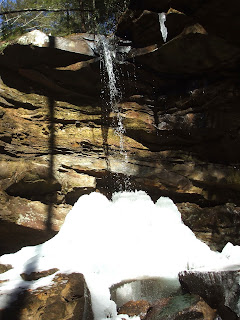
Bell Falls in Red River Gorge

Wednesday, January 26, 2011

Rock Art

     One of the key aspects of the Swift treasure are the numerous natural landmarks and rock carvings.  Most serious minded modern treasure hunters have several locations in mind of markings etched into the rock, presumably to give a direction or a clue to the whereabouts of the mine. Turkey tracks, buffalo rocks, circles and initials all have been identified at most of the suspected silver mine locations.  Swift also claimed to have stashed large sums of the counterfeit silver coins in several locations and in fact, some hunters have claimed over the years to have found some of those caches of the sought after treasure. And nearly to the person, followed the signs, the rock carvings and, of course, the details of their version of the journal to their claimed site.
     If you are interested and seriously want to explore and try your luck at unraveling the 200+ year old legend you should arm yourself with a copy  of Rock Art of Kentucky that seriously takes an in depth review of some of the most notable rock carvings found throughout the state.  This is the most comprehensive look at rock carvings throughout Kentucky.  Fred Coy, Tom Fuller, Larry Meadows and James Swauger spent countless hours over the years visiting sites throughout the state to record and photograph them.  This collection, published by the University of Kentucky Press, attempts to bring all the known sites together in one volume.

Saturday, January 22, 2011

The Legend is Still Popular

     There are many reasons why I have loved the John Swift Legend for most of my life, but perhaps the single most important reason is because it is without equal, the oldest legend still unsolved and persistent in all of Kentucky.  It was around, according to some historical documents, even before the Commonwealth of Kentucky was created in 1792, the young nation's fourteenth state.  John Filson wrote the first book about the land of Kentucke, The Discovery, Settlement and present state of Kentucke in 1784.  Though, Filson says in his book that no ore had been discovered yet, by 1788 he files a land claim for acres which would include some of this wilderness area and in the deed claim states contains the mine workings of a man named Swift.  This would be the earliest  record of the supposedly mine workings.
     Even today the legend lives on in many different venues.  There have been written numerous books and countless articles about the legend and, in some cases, the discovery of the fabulous treasure.  There have been special events devoted to the exchange of ideas the idea has been used in many business venture promotions. You can type in the the words John Swift Silver on Google search and come up with no less than a 100,000 sites that contain those words and many refer to this exact story. You will also find this blog site listed there in the top five spots!
     Back in the 90's, my friend Mike Steely, author of  Swift's Silver Mines and Related Appalachian Treasures, organized a Silver Mine Weekend in Jellico, Tennessee.   This was a great opportunity for researchers, collectors, treasure hunters and enthusiasts to come together and share information, swap ideas and take field trips to the local areas along the Pine Mountain,  a hot spot for the legend.
The event is no longer held but it would be nice to see some type of  gathering to keep the dream alive.   There is so much history and mystery surrounding this great story.   That is why I decided to write my novel surrounding this wonderful piece of our Kentucky heritage.

Monday, January 17, 2011

Some Notable Background

      The Warriors Path general follows the flat plain along the eastern edge of the Cincinnati Arch, the massive uplift that produced the amazing bluegrass limestone region of Kentucky.  One of the first maps produced of Kentucky, by John Filson in 1788 contains the Warriors Path in about the position as just described.  The trail passed very near the old Shawnee Town of Esskippithiki or Indian Old Fields.  This was the major, north- south route across Kentucky.   John Finley, used it to guide Daniel Boone and party back into the region in 1769.
The Warriors Path is indicated by the dashed line down the center of the map
Court house and county seat of Wolf Co. Ky
     Mentioned in previous posts, indeed the historical marker located on the court house lawn of Wolf County claims that the court house was built upon the old Swift camp site, used when the mining operation was well under way.  The headwaters of Swift Creek run through the town of Campton near this very courthouse.   Interestingly, the only other set of Indian stair steps found in the region is located just a short distance down the creek from the town.  With the Rock Bridge and several other notable landmarks a short distance farther down Swift Creek this area became a hot sport for silver mine hunters in earlier years.  Also, the entire area, including Indian Old Fields, Pilot Knob, and the Red River Gorge lie along the 83 degree parellel.  This latitude in mentioned in most versions of Swift's journal.  It is noted on the right margin  even on Filson's map above.
     There are also numerous Rock Carvings over the region, in fact, in nearly every region of the region.  Some are very early carvings or petroglyphs.  One very notable rock carving is the High Rock boulder that is now on display in the Red River Museum , in Clay City Kentucky.

Sunday, January 2, 2011

Kentucky's Strange Rocks

Old mining workings in Elliot County
     Ask any geologist that knows anything about the geology of Kentucky and they will quickly tell you this state is composed nearly completely of sedimentary rocks, primarily limestones and shales, with sand particle sized stone in many places. The key word here is nearly.   There are exceptions dispersed through out the state. One such anomaly can be found in Elliot County.  Here an igneous intrusion surfaced exposing a ruby/garnet producing rock called peridotite.  This stone is known to produce diamonds around the world.  In fact, the
the Kentucky Kimberlite Diamond Mining
Peridotite found in Eastern Kentucky
Company established a mining operation here in 1907.  Over the years others explored the area until the last serious mining effort was conducted by the Kentanna Minerals Company in 1965-70.  For
 many years the remains of apparatus used in the mining operation set on the outcrop of strange and hopefully rich mother load of diamonds and rubies.  The rock is a black, dense rock, composed mainly of olivine with fragments of garnets and an occasional ruby dispersed throughout the  material. The workings are on private property, and since this post, I have discovered that this property belongs to the family of Matthew Sellers.  Mr. Sellers was one of the first pioneers in aviation.  In fact, he made the first powered flight in Kentucky in 1908.  And actually, flew a glider before the Wright Brothers!  Matthew Sellers' granddaughter, Barbara Sellers has written a wonderful  book entitled "A Moment in Time" that should be read by every Kentuckian.
     There were many other operations following specifically the trail of the legend including this one on the South Fork of the Red River.  Mr. Tipton, in the construction helmet, convinced that he had isolated the vein of silver ore thought to be that of Swift's. The site did produced silvery minerals, but no major discovery was ever reported.
Unidentified rock from the diggings above appears to be pyrite

     Out in western Kentucky deposits of fluorite have been mined for many years.  These deposits are thought to be the result of igneous activities depositing the minerals in the sedimentary rocks that comprise much of the area. People have collected many beautiful flourite crystals from around the region over the years.  The Ben E. Clements Mineral Museum in Marion, Kentucky is said to have the largest collection of fluorite crystals on display in the world.

Fluorite Crystals found in Livingston County
Basically, there are exceptions to the most common geological materials in Kentucky.  While the states' mineral resources are primarily coal and limestone, there have been unusual anomalies discovered across the area.  With that in mind, one cannot positively rule out the possibility that out there somewhere, hidden from detection, still remains buried treasure.  To put in Swift's words, "...don't ever stop looking for a peculiar rock that stands near a stream with three forks, it's near the richest mine I ever saw."

Sunday, December 26, 2010

What an Amazing year-1755

     For all those that follow and treasure the Swift mine lore, one of the key elements in all versions of the supposedly Swift journal is the per chance meeting Swift had with a Frenchman named George Munday, sometimes spelled Mundy.  In nearly all accounts of the legend John Swift joined the pioneer militia and combined British army under the command of General Edward Braddock.  This time being before the winds of revolution evolved into all out war, the single purpose here was that the French had established a Fort at the the point where the two rivers combined and formed the mighty Ohio.  Today this location is Pittsburgh.  The French and Indian allies of various tribes  were intent on keeping the British loyal colonist from expanding westward.  It was into this volunteer and regular army that Swift claimed to have joined.  Here he says that he met a prisoner, George Mundy,  that claimed to have been mining and smelting silver south of the Ohio River in the wilderness.
     Now the truly amazing historic fact related to this matter is that  Daniel Boone did join this same army in 1755 and met  John Finley, who claims that he had operated a trading store south of the Ohio in the wilderness as the same time. Finley operated a trading business in Esskippikithiki, the Shawnee town located on the level plain just west of Pilot Knob.  Both events, one the legend, the other historical fact, coincided the same amazing year, 1755.
     Daniel Boone made his second trip into the Kentucky wilderness in 1769.  It was a successful trip because he and his party were led by John Finley.   Finley took the party to near the place he had traded with the Shawnee some 16 years earlier.   The group of hunters set up camp along the largest creek in the area.  It was reported that the men would spend hours around the evening campfire being read the only book brought on the journey.   The book was called Gulliver's Travels, written by Johnathan Swift.  Now that is quite strange, indeed.

Swift Interview

    Just a quick update as promised. The Swift interview will air May 21 at 8:00 PM on KET. The last entry on this site covered the intervie...